Thursday, February 25, 2021


POST #21-34 

Back To Cave Creek Regional Park! 

  ...No snow this time!!

If you're have trouble seeing the entire post, CLICK HERE

Subscribe to get E-Mail notifications of new posts!

Fill the CONTACT US TO SUBSCRIBE fields!

********

Tap any photo or video to enlarge/play.

Tap any underlined links to follow. 

Check out our YouTube Channel to see all of our videos!

********

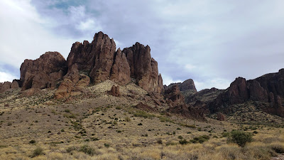
On February 17th we moved from Usery Mountain Regional Park to Cave Creek Regional Park into the same site we had a few weeks ago...


It was a short drive of about 54 miles - Sunny skies, light winds and temps in the 70s.  Perfect AZ weather!


Here is a sped up video of the drive over...


For a full resolution video of the drive click HEREThe weather was MUCH nicer than the snow we had here a few weeks ago!


Here's a drone video of our campsite and a bit of the surrounding desert...The remains of the buildings from the old clay mine we talked about earlier can be seen on the video...


For a full resolution video of the drone flight click HERE.

Here's the mine...


We found this interesting historical information about this area... 

Cave Creek was named for the small stream that rises in the hills to the northeast and flows southwesterly for 25 miles before reaching Paradise Valley. The stream, in turn, was named from a high, overhanging bluff along its west bank that forms a wide, open cavern about two miles north of the present day Cave Creek. People have taken shelter there for centuries. A bloody skirmish occurred within the cave between Apache Indians and U.S. Troops in 1873.

Ancient Hohokam Indians stayed in the area from around 800 A.D. until 1400 A.D. Many reminders of their living in the area still remain. Stone huts, pit houses, terraced field and irrigation ditches were left behind. There are also many petroglyphs that were carved by the Indians.

The Cave Creek area has a rich archeological foundation. Dozens of prehistoric sites have been discovered. However, many more remain undisturbed.

During the 1400s, bands of Apache Indians began drifting into the area. Soon, the Apaches spread throughout the State. They brought with them different lifestyles than the Hohokams. Instead of farming, the Apaches lived by hunting, gathering, and raiding. The 1500s saw the arrival of Spanish explorers. The Spanish found the desert to be very inhospitable. On their maps, central Arizona was labeled as "deplobado" meaning, "desolate wilderness."

Mining began to become a focal point in central Arizona history in 1863. The call "Gold in the Bradshaws" rang out. Fabulous rich gold outcroppings were found in high peaks such as Antelope Hill. In 1864, Henry Wickenburg uncovered the richest strike, the Vulture Mine. Miners were sure that the Aqua Fria River, New River, Cave Creek and the stream of the Tonto were also rich with gold.

A few miners tried to find the treasures, but met the Apaches who ran them out of the area. The Tonto Apaches controlled the area, so for the time being, mining had to wait. Ranchers and farmers followed lured by reports of mild climate, plentiful water, tall timbers and lush grass. All of the reports failed to mention that hostile Indians surrounded the area. Of all the tribes in the area, the Tonto Apaches were the most feared. They ate animals they captured including horses, mules, oxen, and burros. The Tontos were highly mobile, unpredictable, and difficult to capture.

Newcomers to the State appealed to the Federal Government for assistance. The Civil War was demanding the need for every soldier. Washington leaders decided they did not want to lose the potential gold production capabilities of Arizona. In 1863, Arizona was declared a new and separate territory, splitting off from the territory of New Mexico.

A Governor was sent to Arizona along with a small force of troops to Fort Whipple in Prescott. In 1865, the army sent a small force of 300 volunteers from California to establish Fort McDowell. Fort McDowell was located 18 miles east of Cave Creek. One year after the Californians arrived, a regular army infantry unit settled into Fort McDowell. For 15 more years, skirmishes, ambushes, and bloody confrontations raged between the soldiers and the Tonto Apaches. On December 1, 1873, Lieutenant Walter S. Schuyler, of the 5th Cavalry, led a scouting expedition out of Fort McDowell that resulted in the first skirmish along Cave Creek. After weeks of searching for Indians, Lt. Schuyler and his troops found a band of Tontos held up on the West bank of Cave Creek. On Christmas morning the troops attacked the Tontos, killing 9, including one of the most fearless leaders named Nanotz.

Just North of Cave Creek, the area of Bloody Basin was the site of a bitter skirmish on March 27, 1873. Army scouts trailed a group of Apaches to the top of Turret Peak. The scouts crept up the peak during the night. At dawn they captured or killed nearly all of the Apaches. The pressure on the Tonto Apaches began to have its effects. With the army destroying any discovered food storage areas, the Apaches were beginning to suffer. Hunger drove the Apaches to surrender. By 1877 about 5,000 Indians from various tribes shared the San Carlos Reservation. 

The Battle of Turret Peak proved to be a major turning point. The time of the Tonto Apaches along Cave Creek was over and a new era of mining was coming to Cave Creek. 

Interesting info!!

We will be here at Cave Creek until February 28th...

Until Next Time!


Tuesday, February 23, 2021


POST #21-33 

Anniversary Of The Flag Raising

 ...Re-Visiting a post from last year... 

Subscribe to our Blog! 

Get E-Mail notifications about new posts!

Fill the CONTACT US TO SUBSCRIBE fields!

********

Tap any photo or video to enlarge/play.

Tap any underlined links to follow. 

Today, Feb 23 is the 76th anniversary of the Flag Raising on Mt Suribachi....during the Battle Of Iwo Jima...(click any of the links in this post to learn more)


This battle will always be on my mind because my Dad fought in the battle with the 4th Marine Division.  He landed on the Island on Feb 24...two days after his 23rd birthday...


Dad was attached to the 23rd Regiment, Baker Company, as part of a replacement group.  There were so many casualties from the first days of the battle, from the 19th thru the 24th.  As it turned out, Dad was the only member of Baker company to make it off of the Island alive.  This photo was taken on March 26th, 1945 when survivors were gathering to leave the island....Dad is circled... 


He sustained no physical wounds...but I think the emotional scars lasted a lifetime.  He never talked about it until towards the end of his life....Once my Brother-in-Law Frank, a gun collector, brought his M1918A2 BAR Rifle, a light machine gun, over to the house when Dad was visiting...


That BAR Rifle is the exact model of gun Dad carried on the island...He told the story that he was a part of a 3 man squad formed to work with that light machine gun...the gunner, the assistant gunner and the ammunition bearer.  They were all buddies from Basic.  Dad carried the ammunition as well as his own M1 rifle.  As they were coming ashore and moving into position...the assistant gunner was immediately killed by machine gun fire.  Dad and the primary gunner moved forward...then the primary gunner received a shot to the head by a heavy machine gun.  He went down...Dad threw away the M1, picked up the BAR rifle and went for cover.  Dad said he stopped and had to clean his buddys blood and brain matter from the guns receiver to make sure it worked.  Just think...this is a kid that just turned 23.  I can't see how those kids did it...Most of them were younger mostly 18 to 20 year olds...Dad said he was scared s...less when he had the M1, but not so much when he had the BAR.  He also told a story where he was walking alone patrolling a perimeter, when a Japanese officer came running out of a tunnel screaming and waving a sword.  Dad obliged him with a burst of fire from the BAR.  I'm sure he had to shoot others, but that's the only one that was spoken of.  Us kids never heard any of that while we were growing up...when we asked he sternly told us he didn't want to talk about it.

He was the only member of his Baker company to come home as far as he knew...he said he never saw any of them again...

Dad left that island on March 26th, 1945....He also left this earth on March 26th...2007

None of these guys ever thought of themselves as heroes...But I sure do...

Until Next Time!


Tuesday, February 16, 2021


POST #21-32 

We Return To Usery Mountain Regional Park

 ...Another wonderful Maricopa County Park... 

Subscribe to our Blog! 

Get E-Mail notifications about new posts!

Fill the CONTACT US TO SUBSCRIBE fields!

********

Tap any photo or video to enlarge/play.

Tap any underlined links to follow. 

On February 10th Tomorrow we leave the "Supes" (Superstition Mountains at Lost Dutchman State Park) and made the short drive over to Usery Mountain Regional Park...

It was a very short drive of around 13 miles under partly cloudy skies.  About 65 degrees with light winds...


It's kind of sad when we leave a spot where we have been for a couple of week...especially a spot like the Superstition Mountains!  It was nice that we could still see them in the distance!


And a wonderful sunrise over the "Supes" on our first morning!


But here at Usery it's very scenic too....A lot of Saguaro Cactus....all around us!  And the temps have been in the range of 70 degrees!  Nice!


 This big Saguaro is right in our campsite!


And this interesting mountain view is right out our door!


The band through it is volcanic ash from the eruptions at the Superstition Mountains, eons ago....The ash was so hot from the volcano that it welded itself back into solid rock! Then another lava flow over the top of it.  The "Striped Mountain" is a landmark for us....shows us right where our camp is from anywhere in Mesa!

The Arizona Sunsets are spectacular here in Usery!


Really exceptional, like this one!


We are here until February 17th when we move back to Cave Creek Regional Park, where we were snowed on a few weeks ago!  It will be much warmer this time!

Until Next Time!


Tuesday, February 9, 2021


POST #21-31 

A Hike Into The Superstitions..

 ...A short one anyway... 

Subscribe to our Blog! 

Get E-Mail notifications about new posts!

Fill the CONTACT US TO SUBSCRIBE fields!

********

Tap any photo or video to enlarge/play.

Tap any underlined links to follow. 

On February 9th I decided to take a hike up a ways into the Superstition Mountains on the Siphon Draw Trail while camping at Lost Dutchman State Park. The Siphon Draw Trail link has a lot of great info and photos!


The trail ends at the formation known as the "Flatiron".  


That's a 5.5 mile there and back hike with an elevation gain of 2641 feet.  I walked up about 1.4 miles (the line roughly follows the trail).  I packed Sparky the Drone up there to see if I could fly in the safe zone between the park boundary and the wilderness boundary.


I got as far as the big pointed rock that's on the right side of the photo...


It was getting late, the trail was getting very rough and steep and there was a long way to go to the Flatiron.  


Every evening we could see folks descending the trail, in the dark, with flashlights, but...Think I will pass on that one!  Found some interesting signs along the way...


Came across this old concrete work along the trail...I imagine it's the remains of old abandoned gold mining works...


Stopped and used the flat piece for a drone launch pad and got this video... The video is sped up 3X.  The drone was set in "Sport Mode" which is very fast. It took a long time to get up there and it couldn't stay long cuz the battery went fast in that mode! Tap the arrow on the video to play.

Click HERE for a full resolution video...


As I crossed the Wilderness boundary the terrain got rougher and the rocks, boulders and monoliths got bigger...


Took a video with my phone from this area...tap arrow to play...  


Looking back down...and sunset!


By the time I made it back it was almost dark and the stars were starting to show...


Tomorrow we leave the "Supes"....Destination Usery Mountain Regional Park...

Until Next Time!


Monday, February 8, 2021


POST #21-30 

Special Visitors To Our Camp Near The "Supes"!

 ...Always nice to have fun visitors! 

Subscribe to our Blog! 

Get E-Mail notifications about new posts!

Fill the CONTACT US TO SUBSCRIBE fields!

********

Tap any photo or video to enlarge/play.

Tap any underlined links to follow. 

While we were here at Lost Dutchman State Park we had several folks stop by but two were special and memorable.  


First Barbi's brother Frank and his wife Kathy came all the way from home at Billings, MT to visit.  They were in Scottsdale for a week and we met up several times!


Then, later during our stay we met up with YouTube Creator Robert Morales, known as "Traveling Robert" .  Robert has a very successful YouTube Channel with over 173,000 subscribers and over 42 million views!  Check it out HERE We watch his videos often and find them entertaining and informational!
He produces and performs all of his music, records voices and edits his videos...does an exceptional job!  Tap on the arrow in the following video for a sample of Robert creating music to use in his YouTube videos. 


Here is Roberts camping rig "Mini-Tini 2, parked near our campsite...


Robert stopped by for a visit and a beer...Bill the cat was all over him!  We all had a great visit!  Robert is a super nice guy!


I stopped by the next morning to purchase a "Free In My RV" sticker as Robert was preparing to leave on the next leg of his trip...


And placed it on our "Sticker Wall"


After all of the fun of special visitors it was back to just us!  Barbi and Mikey!


And of course Bill and Ted on their most excellent adventure!


And that ain't bad!

Until Next Time!